


tour de Aime la Plagne

ramsay
User
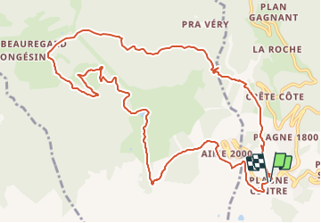

Length
13.5 km

Max alt
2125 m

Uphill gradient
572 m
Km-Effort
21 km

Min alt
1638 m

Downhill gradient
566 m
Boucle
Yes
Creation date :
2016-07-07 00:00:00.0
Updated on :
2016-07-07 00:00:00.0
4h33
Difficulty : Medium

FREE GPS app for hiking
 SityTrail
IGN / Geographical institutes
SityTrail Plus
The world is yours!
About
Trail Walking of 13.5 km to be discovered at Auvergne-Rhône-Alpes, Savoy, La Plagne-Tarentaise. This trail is proposed by ramsay.
Positioning
Country:
France
Region :
Auvergne-Rhône-Alpes
Department/Province :
Savoy
Municipality :
La Plagne-Tarentaise
Location:
Mâcot-la-Plagne
Start:(Dec)
Start:(UTM)
318363 ; 5041847 (32T) N.
Comments